
Alameda ZIP Code Directory Map
Alameda’s practical ZIP split is simple enough to use and specific enough to verify. City material identifies 94501 with the main Alameda Island and 94502 with Bay Farm Island. Postal delivery, municipal jurisdiction, county parcel geography, and election precinct geography can still diverge. Start with the returned ZIP, then confirm the address through USPS and the parcel system.
| ZIP | Areas Covered | Post Office | Notes |
|---|---|---|---|
| 94501 | Main Alameda Island, West End, Alameda Point, central area, Gold and Bronze Coast, East End | Alameda/Main and local stations | Verify the exact address at USPS; strongest historic directory and map coverage |
| 94502 | Bay Farm Island, Harbor Bay, and the Mecartney Road area | Bay Farm or Harbor Bay delivery | Verify the station and address; later parcel, subdivision, and permit sources dominate |
| PO Box or unique ZIP | Not established in the official sources reviewed | Use the returned USPS result | Do not assume a separate unique ZIP without an address-level result |
The postal split is therefore a branching tool. The 94501 branch favors old city directories, newspapers, maps, and Alameda Point or central-city records. The 94502 branch favors later plats, permits, subdivisions, and telephone sources. Neither branch supplies a complete list of residents.
94501 Alameda Main Island ZIP Trail
94501 covers the main island zones named in city material: West End, Alameda Point, the central fabric, Gold and Bronze Coast, and East End. These areas carry different record eras. Old directories and Sanborn sheets are strongest where the street grid and buildings predate modern portals. Alameda Point can send a researcher toward federal Navy or civilian publications because its past is not only municipal.
For a 94501 name or address clue, verify the postal address first. Then use the County Parcel Viewer for APN and situs, the City permit portal for work history, and the Alameda Free Library for directories, newspapers, maps, and yearbooks. Use the street name and historical names together when the address has changed.
The Alameda branch helps select the historic shelf, but a parcel and a date still do the identity work. A 94501 result should be labeled as postal geography before it is used in a resident lookup.
94502 Alameda Bay Farm ZIP Trail
94502 serves Bay Farm Island, Harbor Bay, and the Mecartney Road area. Bay Farm’s marsh, fill, and planned-development history means that many present addresses did not exist in early Alameda directories. Later subdivision, permit, parcel, and telephone records are usually more useful than trying to force a nineteenth-century city listing to cover a modern address.
Use the ZIP code as the first branch, then test the exact location in the parcel viewer and city GIS. Keep the APN, situs, and tax mailing address separate. A Bay Farm result may connect to Oakland-facing geography or an institutional parcel even while the postal city reads Alameda.
For an older person clue, look for a later telephone entry, a permit record, a newspaper item, or a business or license filing. The Bay Farm branch is a record-history clue, not proof that a person lived there.
Verify an Alameda ZIP With USPS
The USPS ZIP Code Lookup should be the first address-level check. Postal preferred city names and municipal borders do not always match. Enter the standardized address, record the returned ZIP and city label, and keep the result date with the research log.
- Enter the street number, street name, unit information, city, and state.
- Save the standardized form and the returned ZIP code.
- Compare the result with the Alameda County APN and situs address.
- Check City of Alameda GIS or permit jurisdiction separately.
- Use the ZIP only to narrow the next search, never as the final identity proof.
A ZIP+4 is a delivery refinement, not a new parcel or jurisdiction. A carrier route is a delivery path. A PO-box ZIP belongs to the box service shown by USPS, not automatically to every street address in the city.
- ZIP code
- Postal delivery geography assigned by USPS.
- ZIP+4
- A more precise delivery segment attached to a standardized address.
- PO-box ZIP
- A postal result tied to a box or station, requiring address-level confirmation.
- Unique ZIP
- A special postal assignment that cannot be assumed without an official returned result.
The USPS form makes the postal branch practical. It also prevents a city label from being mistaken for a parcel jurisdiction.
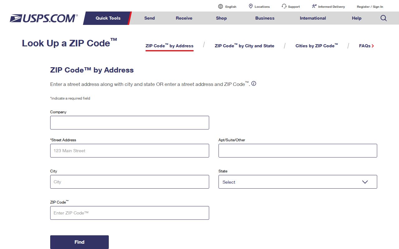
The address-lookup screen shows the right order: standardize first, then branch the Alameda postal search.
Alameda ZIP Clues in Unclaimed Property
California Controller’s unclaimed-property search accepts a last or business name or a property ID, with optional first name, city, and ZIP fields. For Alameda research, 94501 and 94502 can narrow a name search. Exact names appear before similar names. A result can show a historical city and ZIP association, but it is not proof of current residence or entitlement.
| Required route | Last or business name, or property ID alone. |
|---|---|
| Optional filters | First name, City, and ZIP. |
| Result action | CLAIM, then CONTINUE TO FILE CLAIM. |
| Meaning | A location clue attached to remitted property, not a present address. |
Use the ZIP result as one independent anchor. Compare the name and city with a business filing, license, deed party, court case, or directory entry. Do not infer that a ZIP result identifies the same person without a date or second fact.
The California Controller unclaimed-property search illustrates the city and ZIP filter.
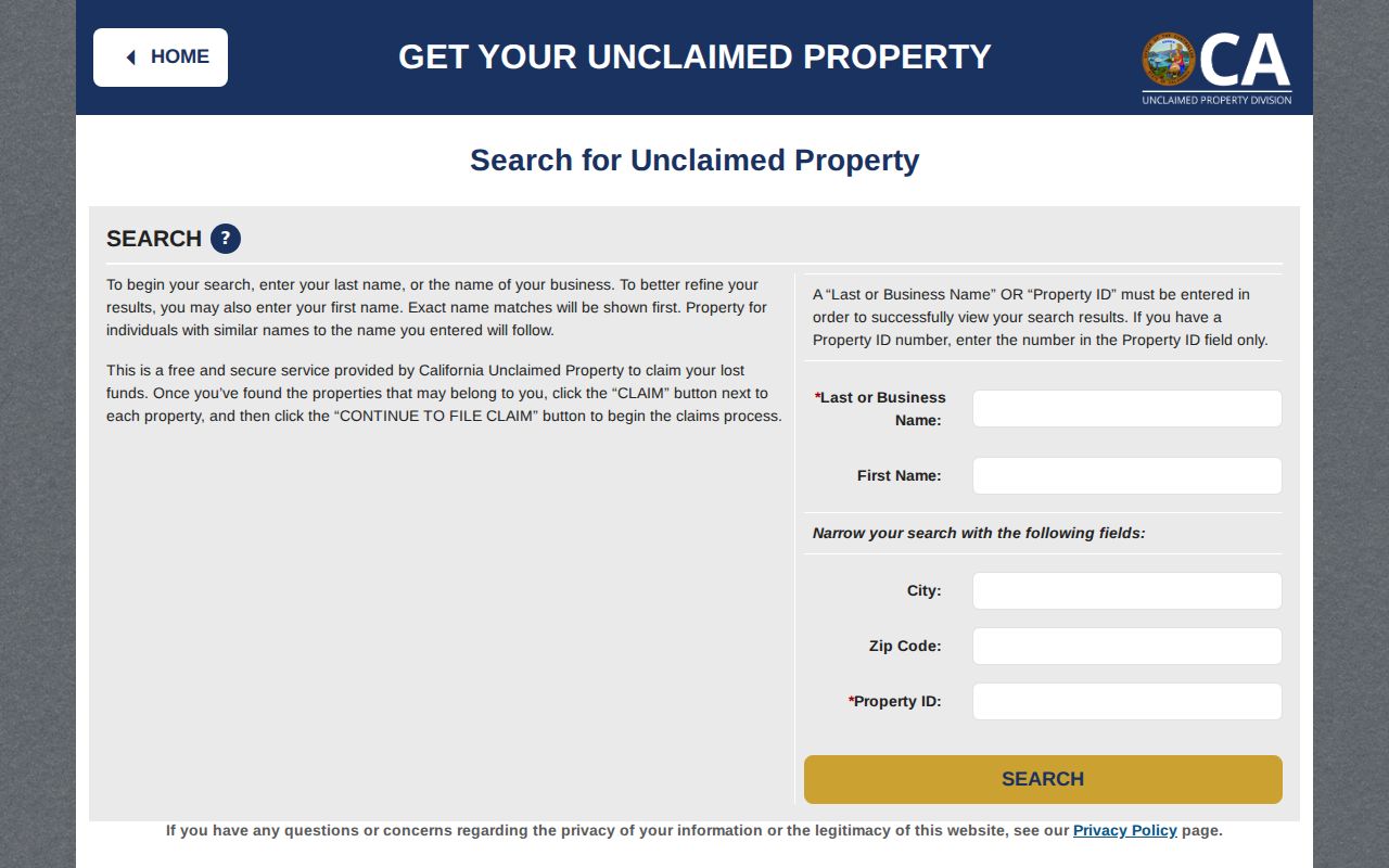
The Controller’s form shows how a ZIP narrows an official name search while preserving the warning that the result is a lead.
Note: A city or ZIP attached to unclaimed property may be old, so it should never stand alone as a resident fact.
ZIP Is Not Alameda City Jurisdiction
A ZIP code belongs to postal geography. An APN belongs to assessment geography. A city GIS layer belongs to municipal planning geography. A precinct belongs to election geography. A resident lookup becomes safer when all four are labeled instead of treated as one boundary.
| Label | What It Describes | Verify With |
|---|---|---|
| ZIP | Delivery branch and postal sorting | USPS address lookup |
| APN | Assessment parcel and tax geography | County Assessor |
| Situs | Physical land location | Parcel card and map |
| Precinct | Election administration | Voter status or election office |
Edge cases include estuary facilities, Coast Guard Island, Oakland-facing waterfront, Bay Farm connections, and institutional parcels. A 94501 or 94502 result does not answer whether a parcel is inside a city service area, a precinct, or a specific community group.
When a ZIP search leads to a street, use the Alameda street directory for parcel-by-parcel work. The postal page should not rebuild the full address chain.
Alameda Situs, Mailing, Legal Description, APN
Four labels keep a ZIP result from becoming an unsupported name claim. Situs is the physical location. Mailing is the tax correspondence destination. A legal description is the land text used in a deed. An APN is the assessment parcel identifier and may change after a split or merger. A ZIP can be attached to one of these labels without applying to the others.
Record each label exactly as the custodian displays it. If the tax mailing ZIP differs from the situs ZIP, treat the difference as a clue about where correspondence goes. If the deed legal description covers more than one parcel, check the APN and map before connecting a person to one street.
A city directory entry has its own address form, which may use an old street name or locality suffix. The postal split helps branch modern research; it does not rewrite the historical address.
Alameda Estuary and Institutional ZIP Edges
Alameda’s water edges make postal and municipal lines especially important. Coast Guard Island, waterfront facilities, Bay Farm connections, and institutional parcels may return a postal label that does not answer a city-service question. A ZIP map can be a useful orientation, but the parcel viewer, City GIS, permit portal, and election source should be checked separately.
Do not assume that every address with an Alameda mailing label belongs to the same record history. An institutional address may have no household directory trail. A shoreline parcel may have a legal description that reads differently from its street label. Record the facility or parcel context before searching for people.
Alameda Street Zones Refine ZIP Results
West End, East End, and Bay Farm are useful local refinements inside the ZIP split. Public Works places West End between the city limit and Grand, East End between Grand and High, and Bay Farm from High to the eastern limit. APD sectors also use Wilma Chan Way and Park Street, with smaller beats inside them.
Historic searches should include Railroad Avenue and Lincoln Avenue, plus Constitution Way and Wilma Chan Way. The latter name changed in 2022. Keep old and current names in the same log so a ZIP branch does not hide a renamed street.
The ZIP code narrows the branch. The street and parcel identify the physical unit. The record type then determines whether to use permits, deeds, directories, court, or a city request.
Alameda PO Boxes Need ZIP Verification
No separate Alameda-wide PO-box-only or unique ZIP was located in the official sources reviewed. The safe rule is to use the exact USPS result rather than assume a box ZIP from a city name. A box may point to a station, while a street address points to a delivery route and parcel.
For a ZIP search, capture whether the source returned a street address, a box, a business location, or a general city association. Then use the appropriate custodian. A box result may help contact a business or claimant, but it cannot establish a home or parcel connection.
Keep the uncertainty visible. An explicit official-source gap is more useful than a guessed unique ZIP that sends the next search into the wrong geography.
End the Alameda ZIP Branch
The best Alameda postal workflow ends when delivery geography has done its narrowing job. Standardize the address, confirm 94501 or 94502, branch to the main island or Bay Farm record era, and then resolve the exact parcel through county GIS. Keep the tax mailing and situs labels apart.
From there, use the source that answers the question: permits for work history, deeds for named parties, directories for historical listings, court for public case links, business and license registers for public roles, and official requests for records that are not routinely posted.
ZIP stopping point. A ZIP narrows the search. An APN, instrument, case number, edition, or public filing supplies the evidence.
That sequence keeps the Alameda ZIP code directory useful without turning postal delivery data into an unsupported resident claim.