
Alameda Neighbors Around One Block
A block-level neighbor lookup combines map geometry with carefully labeled records. The County Parcel Viewer supplies boundaries and APNs. City GIS supplies zoning, General Plan, and FEMA flood context. The Assessor and recorder add ownership clues. Permits add address-based work history. Directories and phone books add historical listed adults. Community organizations add public contact or meeting information, not a private household roll.
| Source | What It Shows About a Block | Access |
|---|---|---|
| County Parcel Viewer | Boundaries, APNs, situs addresses, adjacent polygons | Free map selection |
| Citywide Viewer | Zoning, General Plan, FEMA flood, assessor-derived context | Free GIS layers |
| Assessor and deeds | Owner or mailing clues and historic title chain | Address/APN then party index |
| ACA permits | Address work history, inspections, public participants | Post-1995 portal and earlier files |
| Directories and phones | Historically listed adults or subscribers along an address sequence | Library, in person |
| Community layer | Meetings, associations, civic or business contacts | Public pages; rosters may be private |
The table keeps the block term grounded. A parcel owner is not automatically the person next door. A directory subscriber is not every occupant. A civic group is not a public membership list. Map the block, then verify each clue in its own source.
Click Parcels Around an Alameda Address
Start with the known situs in the County Parcel Viewer. Save its APN and geometry, then click each adjacent polygon one by one. The research verified map selection and adjacent parcel inspection, but not an automatic radius, buffer, or export control. A manual parcel sequence is slower and more reliable for corner lots and irregular blocks.
- Search the known address and record its situs and APN.
- Zoom out enough to see the surrounding street segment and parcel boundaries.
- Click each adjacent polygon, saving APN, situs, and boundary notes.
- Resolve ownership or mailing clues through the Assessor without calling them occupancy.
- Check only the related permits, deeds, directories, or community sources needed for the question.
CommunityView and the County viewer have different scopes. Preserve the viewer name with each observation. A map context can show flood or zoning conditions, but it is not a certified title search or a complete list of people next door.
- Adjacent parcel
- A mapped assessment polygon next to the starting parcel.
- APN
- The assessor’s identifier for that parcel, which should be saved before moving on.
- Block radius
- A useful description for research, not a verified automatic tool in the reviewed GIS controls.
- Owner clue
- A recorded or assessed ownership fact that does not prove present occupancy.
Add Alameda Zoning, Flood, and Planning Layers
The City of Alameda Citywide Viewer uses Layers to show zoning, General Plan designation, FEMA flood data, and assessor-derived context. CommunityView can help explain why neighboring parcels have different uses or why a street’s geography looks different from its postal label. The FEMA 100-year layer is reached through Legend, Environmental, and FEMA 100-year.
These layers describe regulation and geography. They do not tell a searcher who occupies an address, who belongs to an association, or who voted there. Keep the map observation in a context column and use the parcel, deed, permit, or directory source for person-related evidence.
Alameda’s West End, East End, Bay Farm, and former Naval Air Station areas also have distinct record histories. A neighbor question may need a city planning layer in one area and a historic directory or federal source in another.
Look for Block-Level Permit Patterns
The City Accela portal searches permits by address, APN, record number, keyword, module, and date range. Use the saved APNs from the map sequence. Post-1995 records are in ACA, while pre-1995 microfiche has been digitized. Record processing status, inspection notes, and public attachments when the portal permits viewing.
A permit can connect an address to a work event, applicant, owner contact, contractor, or inspection. It does not establish that the named participant was an Alameda neighbor. Copyright can prevent plan downloads even when an attachment is listed. When the portal returns nothing, note the negative search and date before requesting a nonroutine record.
The permit chain can reveal a block’s building-change pattern, such as several adjacent parcels receiving work in one era. That is a property-history observation, not a household conclusion.
Historic Alameda Neighbors in Directories
The Alameda Free Library’s city directories and telephone books provide the historical neighbor layer. Directories cover microfilm from 1869-1877 and hardcopy volumes from 1877-1943. Most telephone books continue through 2013. A street guide or criss-cross section can place listed adults or subscribers at nearby addresses.
Combined East Bay volumes require the `A` locality suffix and the full street address. Pair a directory year with the census nearest to it, then check newspapers, permits, deeds, or obituaries. A missing name can mean a move, an unlisted service, a missing issue, or a changed spelling.
Historical block listings are therefore a sequence of documented entries. They are not a current block roster. Use the Alameda street directory by address when the goal is a whole named street rather than the immediate block.
Voter Data Cannot Browse Alameda Neighbors
Alameda My Voter Profile and California My Voter Status authenticate one voter. The fields include name, date of birth, an identification choice, and last four Social Security number digits or a no-number choice. The service can return registration status, polling place, districts, language, party preference, and ballot information for the authenticated voter.
California voter files are a separate regulated access path under Elections Code sections 2187, 2188, 2194, and related regulations. Approved election, scholarly, journalistic, political, or governmental purposes may qualify. Commercial use, unapproved solicitation, harassment, and similar misuse are prohibited. A request for up to ten specific voters is not a permission to list everyone on a block.
The Alameda County My Voter Profile form shows the self-authentication boundary.
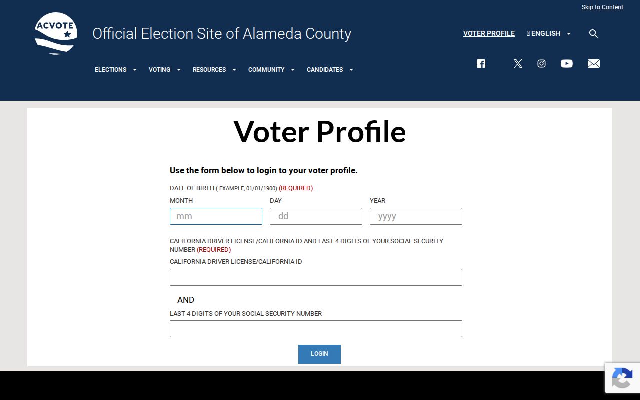
The voter-profile screen shows the self-authentication boundary. It can answer the voter’s own election question, not supply a public neighbor browser.
Note: A voter file is not an Alameda street directory, and an absent public result is not proof that a person is unregistered.
Alameda Harbor Bay Civic Contacts
Community contacts add a different meaning to the Alameda block. The Community of Harbor Bay Isle Owners’ Association is a master association. Downtown Alameda Business Association and West Alameda Business Association describe commercial corridors. Alameda Chamber supplies business contacts. Neighborhood Watch is a voluntary, self-coordinated block network. APD Community Beats offer public meetings and geography.
| Harbor Bay Isle association | Master association; any member directory is private and no public roster was found. |
|---|---|
| Downtown Alameda Business Association | Park Street and east commercial corridor contacts, not a household roll. |
| West Alameda Business Association | Webster and west commercial corridor contacts, not a household roll. |
| AAPS | Preservation society founded in 1972 and incorporated in 1975; programs and newsletters. |
| APD beats | Community geography and public meetings through the City Police page. |
Use the APD beat-meeting page for public engagement information. A group’s existence does not make its members or household contacts public. Community geography is useful for understanding a block, not for inferring private associations.
Alameda Has Forty HOA Leads
The City outreach inventory mentions 40 homeowners associations, but the searchable extract does not name an authoritative list of all 40 or provide a complete set of join links. That is a meaningful research gap. It prevents a neighbor lookup from presenting an invented directory of associations.
Use a named association’s own public contact path when one is published. For an unnamed area, use the parcel map, APD beat geography, planning layer, or a public City records request to identify the proper civic office. Do not infer membership from ownership or from being near an association boundary.
Note: The documented count is a lead for community research, not proof of a public membership roster.
Alameda Official Rolls and Neighbor Tools
Official records and commercial neighbor tools serve different purposes. A public custodian identifies the record type, access boundary, and update path. A commercial compilation may merge filings, purchased data, and inferred associations without explaining whether an address is situs, mailing, business, or former. It can be stale or combine two people with the same name.
| Layer | Strength | Limit |
|---|---|---|
| Parcel and deed | Traceable land and recorded-party evidence | Ownership does not equal occupancy |
| Directory and phone | Dated listed-adult or subscriber clue | Gaps and incomplete household coverage |
| Community contact | Public meetings and organizational geography | Member rosters may be private |
| Commercial compilation | May suggest a lead across mixed sources | Source, date, and identity can be unclear |
The California DROP portal illustrates a current privacy-control route for covered data brokers.
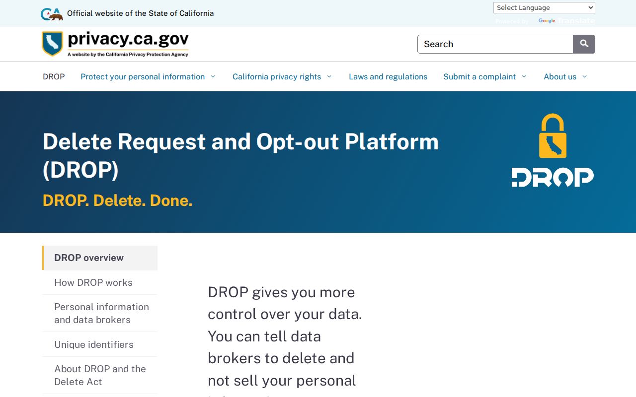
California’s DROP portal illustrates a current privacy-control route for covered data brokers. A person can submit a free verified request, save the DROP ID, and review status without treating a compilation as official proof.
Privacy Limits on an Alameda Neighbor Lookup
A neighbor lookup cannot lawfully reveal every person near an address. People not named in public records, children, guests, unlisted subscribers, utility customers, delivery customers, DMV addresses, confidential voters, and Safe at Home participants are not a public block list. Ownership, a directory entry, a business contact, or an association page should not be expanded beyond what the source actually says.
For a nonroutine election or City record, use the proper request route. The Alameda Registrar of Voters public-record request form asks for the requester’s contact information, a description, date or election context, and preferred response. A focused request does not override voter-file restrictions or protected-address rules.
The Alameda Registrar of Voters public-record request form shows the proper fallback when a record is not routinely published.
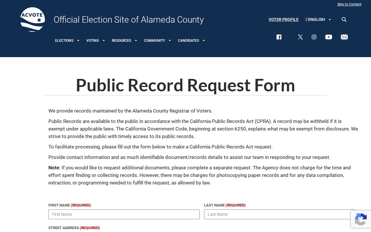
The request form shows the proper fallback when a record is not routinely published. It does not turn the election office into a household directory.
Lawful use. Use Alameda neighbor records for personal, lawful research, family history, property context, and civic participation. Do not stalk, harass, intimidate, or harm anyone.
Stop at a confidentiality program or sealed record. Verify with the custodian, correct errors at the source, and leave an unresolved identity unresolved.