
Find Alameda Streets by Address
The street directory workflow begins with the physical address, not a guessed name. Alameda County’s parcel tools can locate the land, while the recorder’s index can follow a named party after the parcel search supplies an owner or instrument clue. A historic street directory then adds the listed adult or subscriber who appeared at that address. Each step answers a different question.
- Enter the full situs address or APN in the Alameda County Assessor Parcel Viewer and save the returned APN.
- Use the map to inspect the parcel shape and, if needed, click adjacent polygons one at a time.
- Compare the parcel’s ownership and mailing clues with the latest deed instrument or party name.
- Search the Alameda recorder by grantor or grantee name because the deed index has no street or APN field.
- Use permits, directories, telephone books, and census schedules to test whether a listed adult was connected with the address in a particular era.
The result is an address evidence trail, not a list of every person at the property. A multi-unit parcel may cover several homes. A directory may omit an unlisted subscriber. A deed may name an owner who never lived at the situs. The address trail stays accurate when those limits are stated at each handoff.
The Alameda Parcel Viewer Route
The Alameda County Parcel Viewer accepts APN, site address, or map selection. The site address is the best entry when the clue is a street. The APN is the stable bridge to the assessor, tax, permit, and deed records, even when a street name later changes. Save the displayed spelling, parcel number, and situs before leaving the map.
| APN | Text search; keep every zero and hyphen exactly as returned. |
|---|---|
| Site Address | Text search for the physical address associated with a parcel. |
| Select Parcel | Map click for an unclear address or an adjacent-parcel check. |
| Pan and Zoom | Street browsing tool; a buffer, radius, and export control were not verified. |
A parcel is a unit of land in the assessment system. Situs means the physical location. The tax mailing address is where correspondence goes. A legal description is the land text in a deed. These labels should not be collapsed into the word resident.
- Parcel
- An assessment unit identified by an APN and mapped boundary.
- Situs address
- The physical location tied to the parcel, which may differ from mailing.
- Plat
- A recorded map or subdivision drawing that helps describe land layout.
- Criss-cross directory
- An address-order directory section that lists a subscriber or householder rather than every occupant.
Note: An APN is a powerful address key, but an APN result still needs a separate source before it becomes a person clue.
Alameda Street Records in One Chain
Address records become useful when their different roles are kept visible. The assessor locates a parcel and may identify an ownership interest. GIS adds boundary, zoning, General Plan, and flood context. The recorder shows named parties and instruments. The City permit system dates work at an address. Historical directories show listed adults or subscribers. Voter status remains an authenticated personal service, not a street browser.
| Record Set | Keeper | Address Evidence | Access |
|---|---|---|---|
| Parcel and assessment | Alameda County Assessor | APN, situs, tax mailing, property facts | Free address or map route |
| GIS layers | County and City of Alameda | Boundary, zoning, plan, flood context | Free viewers |
| Deeds and liens | Clerk-Recorder | Named parties, type, date, instrument trail | Party index; image by office or order |
| Permits | City Permit Center | Work, applicants, inspections, status | ACA and historical files |
| Directories and phones | Alameda Free Library | Listed adults, subscribers, address sequence | In-library collections |
The parcel number ties the land record to a permit and helps confirm the legal description on a deed. The street name helps locate the historical listing. The person name then opens the recorder index. That sequence is why a street directory is more reliable as a chain than as a single lookup.
Walk Alameda GIS Parcel by Parcel
The County Parcel Viewer is useful for a street sequence: search one situs, record its APN, pan to the next polygon, and repeat. The research verified map selection and adjacent polygons one by one. It did not verify a radius, buffer, or export tool, so the street directory should not promise an automatic neighborhood list.
City of Alameda CommunityView adds a different layer set. The City’s zoning and CommunityView guidance directs users to the relevant map. In the Citywide Viewer, use Layers to show zoning, General Plan designation, FEMA flood data, and general assessor-derived context. A flood layer explains geography and risk context. It is not a title record, a resident list, or a certified parcel boundary.
Corner parcels require care. A parcel can face one street while its legal description or mailing clue uses another. Record the geometry, APN, and situs together. For a block question, walk each adjacent polygon and then test each parcel independently instead of inferring a person from a map label.
Alameda Situs and Mailing Addresses
The assessor’s situs is the land location. The tax mailing address is the administrative destination. A match can support an owner-occupancy hypothesis, but it does not prove who lives at the property. A mismatch may point to another parcel, a trust, a business, or an owner who receives mail elsewhere. The street directory should report those facts as separate fields.
Deeds add another layer. A grantee receives an interest in a legal description. A grantor transfers an interest. Neither role enumerates people not named in the record, children, guests, roommates, or every household member. Building permits add applicants, contractors, inspection notes, and work dates, but a permit participant is not necessarily an occupant.
Address discipline. Keep situs, mailing, legal description, APN, business address, and directory address labeled. Similar-looking addresses can point to different record types.
When an address clue comes from an old envelope or directory, normalize street names without deleting the original form. Alameda street names include historic changes that can break a modern search.
Alameda Permit History by Address
The City of Alameda Accela permit portal searches public permit records by address, nine-digit APN, permit or record number, keyword, module, and date range. Building, Planning, Fire, and Public Works records can provide a time-stamped change trail for a street address. Post-1995 records are in ACA, while pre-1995 microfiche has been digitized and remains viewable through the Permit Center. The City Clerk Key Documents database adds municipal records and historical building-document context.
| Search Field | Type | Required | What It Does |
|---|---|---|---|
| Global keyword | Text | No | Search a term, then choose the Building module; results can download to Excel. |
| Permit or Record Number | Text | No | Goes directly to a known record. |
| Address | Text | No | Reports permit history for a situs address. |
| Parcel or APN | Text | No | Uses the nine-digit `00-0000-000` form. |
| Date range | Date pair | No | Limits post-1995 issued records. |
Record Info can expose processing status, attachments, and inspections. Green check indicates completed review, hourglass indicates pending work, and inspection notes can show what was observed. Copyright can prevent plan downloads even when an attachment is listed. If both ACA and the digitized historical search produce no record, make a focused public-record request rather than inventing a construction date.
The City of Alameda Accela permit portal demonstrates the address-keyed municipal layer.
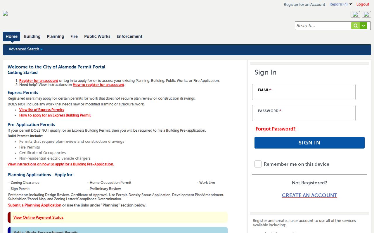
The permit-search screen shows the address-keyed municipal layer. It can date work and identify public record participants, while the parcel and directory layers answer different questions.
Bridge an Alameda Street Clue to Deeds
The Alameda County recorder does not offer an address or APN search for deeds. Start with the Assessor to obtain a current owner name or latest deed instrument number. Then search the Official Public Records Index by party name, instrument, date, or document type. Preserve whether the result names a grantor, grantee, trustor, beneficiary, or another indexed party.
For 1969 to the present, the web index is the discovery route. At 1969, switch to alphabetical grantor and grantee microfilm at 1106 Madison Street in Oakland. The recorder’s land records reach back to 1853. Images are viewed or ordered through the office because Government Code section 7928.215 prevents recorded-document images from being posted online.
A deed image can reveal the legal description, APN, instrument number, date, and transfer clues that an index cannot. Match the legal description before connecting the party to the street. If a seller owns several parcels, a party-name hit alone is not enough.
Note: A street directory can locate the parcel first, but the deed trail becomes name-keyed as soon as the owner search begins.
Old Alameda Names and Three Street Zones
Alameda’s street geography has more than one useful division. Public Works describes West End streets from the city limit to Grand, East End streets from Grand to High, and Bay Farm streets from High to the eastern limit. The historic trail also runs through Alameda Island, Bay Farm and Harbor Bay, and the former Naval Air Station Alameda Point.
Search old records under Railroad Avenue and Lincoln Avenue, and under Constitution Way and Wilma Chan Way. The latter change occurred in 2022. Preserve both the historical and current name beside the APN. A directory, permit, or newspaper that uses the earlier name may otherwise appear unrelated to the modern address.
Alameda has 128 centerline street miles, according to the local research, but the number does not turn a map into a people list. It simply explains why a manual parcel sequence benefits from a clear zone and a saved APN.
Read Historical Alameda Streets
Older Alameda city directories and telephone books can place a listed adult along a street when current records cannot. The Alameda Free Library holds 1869-1877 directory microfilm, 1877-1943 hardcopy city directories, and most telephone books from 1935-2013. Reverse or street-guide sections can connect an address to a subscriber or householder.
Combined East Bay volumes require locality discipline. An OCR hit can belong to Oakland or Berkeley unless the address and the `A` locality suffix establish Alameda. Copy the year, publisher, page, spelling, spouse notation, occupation, address, and abbreviation key. An absent name can mean a move, an unlisted number, a missing volume, or a changed household, not one certain event.
The historical shelf and its entry-reading method are covered in the Alameda city directory collections. The street directory uses that material only to test an address trail.
Limits of an Alameda Street Directory
No public Alameda street directory enumerates every current household. The public sources described here do not supply all people not named in a record, children, guests, unlisted subscribers, utility customers, delivery customers, or people using protected addresses. The voter portal is an authenticated personal service. Safe at Home can substitute a state mailing address for eligible participants, and DMV address information is restricted by the federal Driver’s Privacy Protection Act and state law.
Ownership is not occupancy. A directory entry is not a deed. A business or agent address is not necessarily a home. A confidential or sealed record remains unavailable even when a related public record exists. These are not technical gaps to work around. They are the access boundaries attached to the records.
Lawful use. Use Alameda address records for personal, lawful research such as family history, property history, or civic questions. Stalking, harassment, intimidation, and harm are prohibited.
Stop when the source becomes protected or the identity cannot be resolved with independent anchors. Verify with the custodian that created the record, and correct a wrong assessor, deed, permit, or voter record at its source.
Order the Alameda Record Behind the Index
A complete Alameda street directory search often ends with an office or mail step. The Clerk-Recorder offers public counter research in Oakland and Dublin. The recorded-document index is free, but image access uses the office or an order tied to the instrument number. The county research reports plain copies at $3.50 per page, certified copies at $4.50 for the first page plus $3.50 for each additional page, and a $2 online convenience fee. Mail delivery is reported at five to ten business days.
For a current parcel, call the Assessor at 510-272-3787 when the latest deed instrument is needed. For an older chain, use the 1853-1968 alphabetical microfilm. For permits, use ACA and the digitized pre-1995 files. For historic occupants, use the library’s in-library shelf. Each access channel handles a different failure point.
Keep a compact research log with the address as typed, APN, date checked, portal, result, and next custodian. That habit prevents a street directory from turning a mailing address into a residence claim or a permit applicant into an occupant.